Wintry Mix Start Possible Tonight

The more I dig into the weather for tonight and tomorrow the more I think we will get some wintry mix. As the sun disappears behind the clouds. I have decided to remove the smaller gauge out of my rain collector in anticipation for this system moving in starting off with snow. It looks to be starting off with mix, moving to rain, then the colder air moving in behind the end of this system. Blue Springs may wake up to some light icing Monday morning then warm up and then additional icing on the predawn to several hours after sunrise on New Years.

The isobars indicate some higher winds since they are closer together. That alone may cause some freezing. We are expecting up to an inch of precipitation.

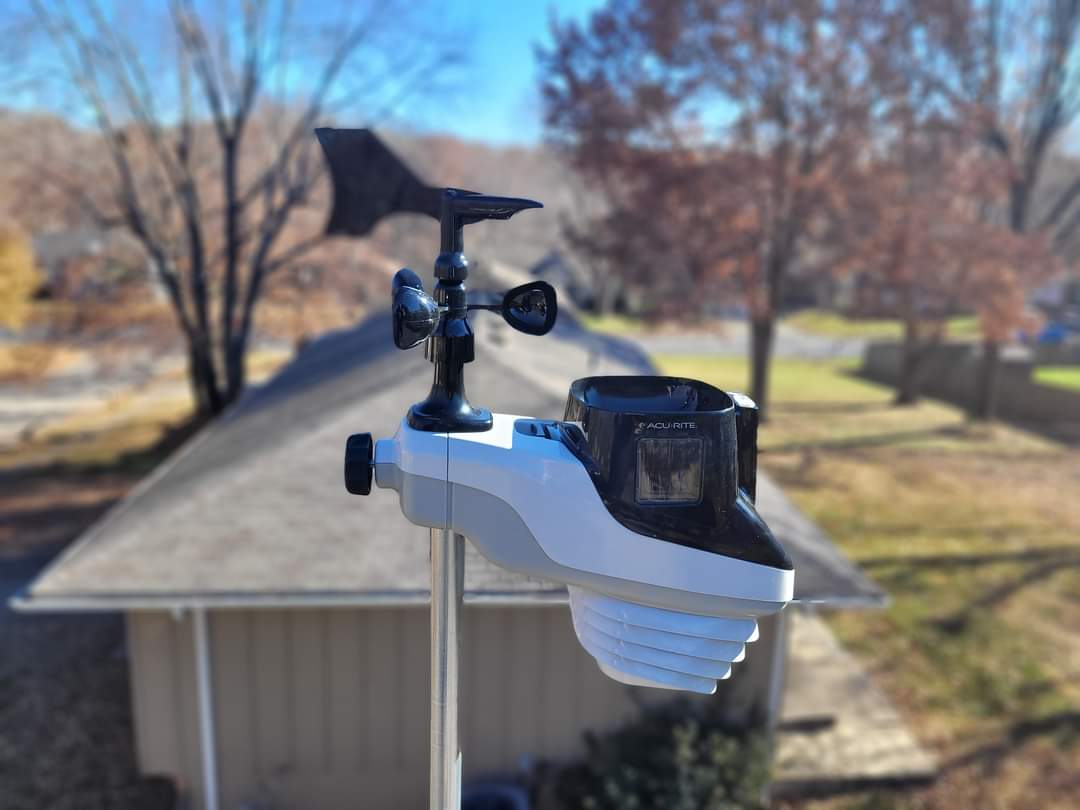
I look at the numbers on my Acu-Rite 5 in 1 and it shows 38 degrees F and steady. Humidity of 59% and falling. The Barometric pressure is 1011 millibars and falling. Winds are 5 mph west north west and a windchill of 35 degrees F.
Time to Get Back to Normal

Hope everyone enjoyed the nice 58 degree weather today. We are about to get back to our normal winter cold as the temperatures start to tank. Saturday morning may be in the single digits with the windchill, but we will be drying out. Sunday will be struggling to 40 degrees. The models show no precipitation up through the weekend.

Over the past 24 hours or so we have received 1.12 inches. It was breezy today. The most wind we received today was 22 mph.

Currently we are at 38 degrees and falling. Pressure 1002 and rising. Humidity is at 91% and rising. Winds are out of the west at 7 mph. Windchill at 31 degrees.

Wednesday Forecast Will Bring Rain

Good morning and Merry Christmas Blue Springs! I hope this post finds you well. Last night I explained that the Wednesday forecast will be some significant weather that will bring much needed rain.  The models are are really coming together and the forecast is predicting up to an inch and a half of rain over Wednesday and Thursday which is a good thing since we have been lacking any precipitation here in beautiful Blue Springs!

Last night we had .01″ of rain and it came and went.  If you blinked you would have missed it, but at least some precipitation is better than none although a good ole fashioned white Christmas would have been great.

The window of opportunity for moderate to heavy rainfall will be Wednesday night into early Thursday. Rain should end by Thursday afternoon and start to dry back out. There is no sign of snow because of the warm temperatures. Following Thursday afternoon it will become breezy with 25-30 mph winds with temperatures in the upper 50s to lower 60s! It will be a beautiful day continuing through this weekend with another chance of precipitation Monday into Tuesday.

Christmas Eve Weather and Forecast

Looks like we have a very very very light rain going on outside tonight , but as I type this the rain has become light and steady. With the new Acurite weather station hopefully we will see some rain indications on the rain gauge for the 5 in 1 sensor. Eventually I will be expanding the setup with internet access and more sensors.

Acurite 5 in 1 Sensor

Current conditions are as follows:

Temperature: 43 F and steady.
Humidity is at 57% and steady.
Barometric Pressure has leveled off to 1019 mb and steady.
Winds are at 2 mph from the SW. Gusting at times to 6 mph.
Windchill is at 28 F

The models are predicting a fairly large system coming in by Wednesday that could bring in some wind and much needed rain for the Blue Springs area. Looks like the unseasonable warmer weather will continue to hang on while others west of us will receive some significant snow.

December 26 2018 Weather Forecast

December 27 2018 Weather Forecast

If anyone has any updates on the weather in their area please shoot me a Facebook message or comment below.