BLUE SPRINGS WEATHER: December 20, 2022

Here is the latest Blue Springs weather update for Thursday into Friday. The wind will be here by Midnight Thursday morning. Wind Gusts will peak at 37 mph by 9 am. Snow drifting will be an issue in some areas. Temperatures will shift quickly to zero by 6 am. Temperatures will continue to drop and be below zero at -6 degrees by 10 am.

The Weather Prediction Center still shows up to a 40% chance for snow amounts 4 inches and the greater. I still think we will not get past 3 inches.

If you are traveling you are in the last few hours till the point of no return. Probably not a good idea to risk it at all. Snow amounts are still 2 inches guaranteed then up to another inch or so for a total of 3 inches and some change.

That is about it so far, till next time. MP.

I’m

Winter Weather Update – December 19 2022

Wow. I am going to have a lot to write about today. If this system holds out, we will see some significant snow amounts. Keep in mind this is STILL TOO EARLY! So as you read this PLEASE keep that in mind and don’t run out and yell the sky is falling! This is something that I am keeping an eye on throughout the week, and as always please make sure your poke your head in on other pages. I know I do a lot of poking with them and there are certain topics that I am dogmatic about, but they still do the best that they can with a much bigger area that they cover. I only cover one county, and that is why I am so accurate. So with that lets talk about some weather. Keep in mind all that I am about to write about is subject to change very quickly.

TEMPERATURES

Thursday temperatures is going be bitterly cold. On Thursday December 22nd at 3 am the temperatures for Jackson County will be about 33 degrees. By 6 am Thursday morning we will hit 9-10 degrees. By 6 pm on Thursday we will be at -2 degrees. By 6 am on Friday December 23rd we will be at -3. By 6 pm on Friday will be at 4 degrees. See the slide show below on the time line of temperatures.

WINDS

Notice the isobars (lines), those lines being close together means it will be windy. So from Wednesday night at 9 pm till about Christmas make sure you dress in layers. Please do not allow your kids to run around in shorts. Please parent your kids. If this holds out we will see snow drifts and likely very low visibility.

SNOW AMOUNTS

Snow amounts are still up in the air, but this what we have so far. NAM shows 3 inches of snow and RAP Shows about 2 inces of snow. GFS shows about both show about 3.7 inches of snow. ECWMF shows over 6 inches of snow. Then we have the WPC which is most of the time the most accurate. Hopefully it will change, but at this time the WPC says there is a 70-90% change of snow amounts of 4 inches and greater. When you shift to snow amounts based on percentile, there is a 95% chance that all of Jackson County will have 6-8 inches of snow.

So we will just have to wait and see as we move forward. If anything changes I will let you know. MP

Morning Observations / Forecast December 18 2022

Good morning. We have winter weather approaching us over the next 24 hours or so. Today’s observation as of 07:24 am shows the current temperature of 12 degrees with a pressure of 30.31 inches and steady. Winds are at zero. The relative humidity is 82%, with a dew point of 10 degrees. The air is arid. The skies are clear. I reported a trace of snow from the very light spitting of flurries yesterday with no accumulation.

Today’s Forecast is pretty uneventful. The temperature today will be a high of 37 degrees, give or take, by 3 pm. Winds will be calm today and less than ten miles per hour. Skies will clear up until about 4 pm and shift to overcast.

HRRR Temperature 3 pm.
Cloud Cover at 4 pm.

Here is an update on the winter weather approaching us this week. It looks like there may be two rounds of snow this week. The first round looks to arrive around 6 am for GFS, 7 am for RAP, and 9 am for NAM Monday, and it seems like straight snow with no transitions. Snow amounts show about a 50 percent chance of 1 inch or greater. Based on the WPC and the model’s accuracy, my determination is that it will be less than an inch unless something changes. The National Weather Service says 1 inch for the Blue Springs area. Some parts of Jackson County may see 1 inch of snow. The start time depends on which long-range model you look at. We will find a better accurate start time this evening as HRRR comes into view for tomorrow morning.

GFS 7 am Monday
RAP 8 am Monday
NAM 9 am Monday
WPC Snow Probabilities for Jackson County and Blue Springs area.

The temperature looks to reach about 38 degrees by 3 pm Monday. So there is a good chance that the snow will be mostly melted by the end of the day on Monday if it holds out. The GFS model shows a slightly lower temperature at 34 degrees. Again, we will get a better and more accurate reading this evening. Keep watching Facebook.

Morning Observations / Forecast December 17 2022

Good morning. Today’s observation as of 8:10 am shows the current temperature of 21 degrees with a pressure of 30.01 inches and steady. Winds are out of the ESE at 4 mph. Relative humidity at 65% with a dew point of 14 degrees. The air is pretty dry. The skies are overcast.

The forecast for today. We will reach about 31 degrees give or take by 2 pm today and will begin to drop by 4 pm today. By 3 am in the morning temperatures will increase to about 37 degrees as the cold front moves through the area and rain begins at this time.

HRRR Temperature at 2 pm CST
HRRR Temperature at 3 am CST

The precipitation starts out as rain but then by 6 am Monday morning rain will shift to snow.

HRRR Precipitation Type at 3 am
HRRR Precipitation Type shifting to snow by 6 am

As for accumulation, it looks to not be much according to the Weather Prediction Center. We have a 5-10% chance of snow amounts of one inch or greater by noon Monday.

WPC Snow Accumulation probabilities at 5-10% at One Inch or Greater

By 6 pm Monday evening the chances increase slightly to ten to twenty percent chance of snow amounts one inch or greater.

WPC Snow Accumulation probabilities at 10-20% at One Inch or Greater

That is pretty much it for today. Be careful driving Monday. Take care. MP

Morning Observations / Forecast December 16 2022

Good morning. Today’s observation as of 6:21 am shows the current temperature of 22 degrees with a pressure of 29.87 inches. Winds are out of the NW at 10 mph. Relative humidity at 67% with a dew point of 16 degrees. Skies are clear.

For today’s forcast the wind gusts will peak to about 26 knots or about 30 mph give or take by noon today.

HRRR Windgust at noon on December 16, 2022

Dress accordingly and no I am not going to post anything about wind chill or feels like temperature. It is way over rated and it is a relative “calculation”. One of these days I am going to write a post on why you should not rely on Wind Chill and Feels Like Temperatures. Believe it or knot the National Weather Service had to “modify” the formula for wind chill because it was too high. Well how does one know that a feels like temperature or a wind chill calculation is too high? I have read that there were several research articles on this particular topic that forced this to be changed. I have not been able to find those articles just yet. I have not thoroughly searched the web either. I just need to set aside some time one morning to do some searching. I know these were done before 2001 according to what I have found.

The temperature will be around 31 degrees give or take for a high today by 11am this morning so again, dress accordingly.

HRRR Temperature at 11am CST

As for cloud cover, we will begin to shift to overcast by 11am today give or take. Temperatures will begin to drop about that time and by 10 pm, temperatures will be around 26 degrees or so and falling.

HRRR Temperature 10pm CST
HRRR Average Cloud Cover 11am CST

That is pretty much it for today. Not a whole lot going on. Happy Friday everyone. MP

SOLAR STORM WARNING December 8-9

SOLAR STORM WARNING December 8 and 9th. What does this mean? It means earthquakes and volcanic eruptions somewhere across the world. This is because of the massive sunspots that are currently moving across the sun. Minor G1 class geomagnetic storms are possible with this event. This can still cause radio blackouts and GPS interruptions resulting in flight and ship delays in the affected areas (affected areas can be found on NOAA site by the weekend) those with pacemakers should avoid flying during the storm as it could affect the motherboard of the device.

That big ball of flame in the sky does far more than give us light and heat. The sun majorly affects everything from all types of weather to earthquakes to volcanic eruptions. man has very little if any impact on anything related to this. The only climate change we need to worry about is the future grand solar minimum that will be taking us into a famine that will affect the entire world and it’s food sources and much more.

If you are reading this post please keep coming back. Over the next several years I will be posting several research papers about how our sun affects our earth, from the environment to the weather. This is REAL science with REAL PROOF and REAL TRUTH! Till next time! MP.

Morning Observations – December 3. 2022

The skies are mostly clear today. Light intensity is sitting at 41680 lx. Temperature at 23.4 degrees and rising. We will only get to about 35 degrees give or take. The barometric pressure is pretty high. Sitting at 30.65 inches and steady. The dew point is sitting pretty dry at 12 degrees. Winds are out the WNW at 7 mph. We are expecting overcast by 3pm today. No preciptiation expected.

Not a whole lot going on the radar.

Current Reflectivity Radar

RESEARCH PAPER – Linking Solar Intensity With Temperature

Bright orange fiery sun with solar flares

Abstract

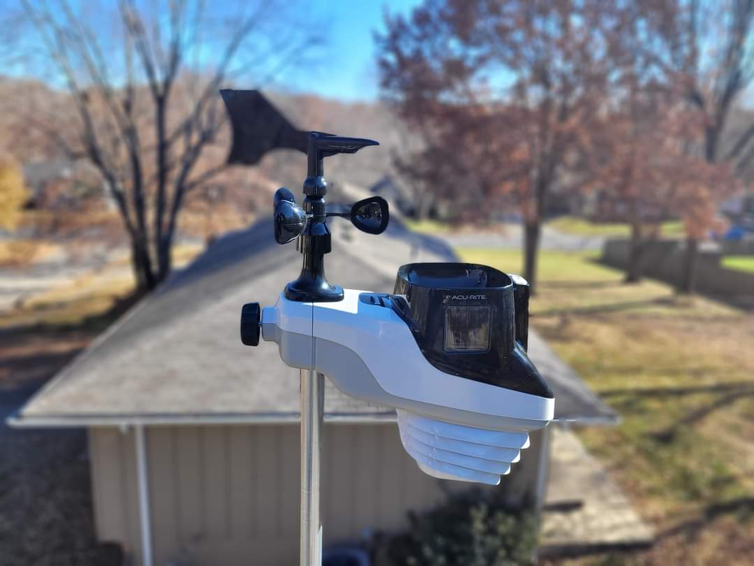
I collected several months of weather measurements based on the AcuRite Atlas 7-in-1 weather station. Since September 1, 2022, I have collected over 25,470 data points every 5 minutes. This revealed an interesting pattern between the sun’s light intensity and temperature and how its light intensity directly affects the environment’s temperature. This is just one of many different research papers that I will be writing based on weather and climate to debunk this push for climate change and global warming and prove that climate change is natural and caused by natural phenomena.

Introduction

There are a lot of papers and discussions about our weather and temperature. While doing a search on this particular topic in comparing the light intensity of the sun to the temperature, there does not seem to be very many papers on it. My hypothesis is this. Can light intensity affect the temperature of the planet? This will reveal what sorts of impacts the sun’s light intensity will have on the temperature of our planet and how much influence it has. This experiment will continue over the next few years since I cannot access any archived historical data on the sun’s light intensity. Without a source, I am stuck collecting all this data myself and making comparisons over time. I hypothesize that measured temperatures will follow the sunlight intensity between seasons. I believe this is due to the earth’s rotation around the sun. Scientists have stated in the past that during the winter, we are further away from the sun, and in the summer, we are closer to the sun.

Materials and Methods

Since I do not have any resources for the sun’s light intensity and measured light, I will have to collect this data myself over time. I started on September 1, 2022, and this data is being collected every twenty-nine days utilizing the AcuRite Atlas 7-in-1 home weather station, and data is downloaded and collected once a month. The data is collected by Atlas every 5 minutes. Timestamp, light measurement in LUX or lx, the standard measurement in luminance, and measured temperature data, which is measured in Fahrenheit, are saved in an excel spreadsheet and used for line graph creations with a trend line added. Thus far, we have collected over 25,470 measurements every 5 minutes since September 1, 2022. This research will continue over the next two years to examine the patterns and associations between the sun’s light intensity and the atmospheric temperature.

Results

Over the past three months, trend analysis reveals a clear link between solar light intensity and temperature. Current data shows a significant association based on trend analysis of the data from September 1 to December 1 of 2022. we will see what happens when we begin to transition into spring around March time and will continue to add to this research as time progresses throughout the research window.

There was an issue displaying the chart. Please edit the chart in the admin area for more details.There was an issue displaying the chart. Please edit the chart in the admin area for more details.

Morning Observations – December 2, 2022 – Wind

Wind problem today. We are under a wind advisory today. According to the Acurite Atlas, we are gusting at 16mph here at the ground level. We hit 20mph at about 5:23 am. Barometric pressure is at 29.86 inches with a temperature of 44 degrees and rising. The Dew point is at 37 degrees which is our current high. The radar is looking really clean and clear. Skies are mostly clear with small clouds sprinkled throughout. The National Weather Service has the entire county under a Wind advisory starting at 9 am till midnight tonight. They say we will have sustained winds from 20-30 mph and wind gusts up to 50mph.

Current Super Res Reflectivity Radar

Rainy And Wet Saturday

Good morning our current conditions are wet and rainy. This is going to be one of those days that you want to curl up in bed and sleep. Every now and then I get an alert for lightning strikes. So far we have had 22 lightning strikes since about 12:55 this morning. The rain did not start till this morning.

Looking at the Accurite rain gauge, it shows we are sitting at 0.13 inches since it started about 6:21 this morning, Current radar shows that this Rain will not be going away anytime soon. The HRRR model shows rain off and on throughout the day today.

According to the various models from the COD, it looks like we should be drying out starting late evening tonight and the rest of the weekend looks to be dry. Skies will be mostly clear to clear and at times partly cloudy. Looks like the evening of the 4th will be dry.

That is about it for today.