Blue Springs Weather: Possible Winter Storm

Good evening. It does not surprise me that Blue Springs weather shifts back and forth like menopause. This happens every season. Winter, spring, summer, fall. The last system was a fairly strong storm in places with only 0.25 inches or precipitation. Why is that? Why do we shift? Because the Earth does not rotate perfectly. It wobbles and, in turn, causes the weather to shift up and down.

Blue Springs Weather Forecast

For now, we are going to focus on the upcoming Friday weather. Mind you, this is still early and will definitely change and shift a little as we move forward. We will start at about 5 pm tomorrow (Thursday) night. It starts off as rain with the temperature at about 47°. According to the HRRR model for the current hour, the rain will shift to Sleet for a short time at 5 am, then shift to very heavy snow by 6 am. It seems that the snow amount, according to HRRR, is 4 inches. Don’t get excited. The WPC shows no real snow accumulation, and the WPC has yet to miss the mark.

So if anything changes, I will update it on social media. Please consider subscribing to my Weather Research site called Project Stormfront. From his site, you will see real science experiments and research papers based on real science. Eventually, I will have ways to support this page and my research on the weather. MP

Blue Springs Weather: 2 Rounds of Rain Sunday

Storm Prediction Center for Blue Springs Weather

Good morning, Here is the latest Blue Springs weather and forecast through tomorrow. We did not get much precipitation yesterday—only 0.01 inches from yesterday’s freezing weather. As I have stated, keep an eye on the earthquake situation over the next three or more days. We have a massive earth-facing transequatorial coronal hole passing by. This will cause the solar winds to increase, and it will affect our environment and cause large earthquakes and volcanic eruptions around the globe, depending on where we are affected. I have proven this to you all from previous Facebook posts. Sunspot activity is still currently at maximum still. You can see that since sunspots are close to the equator on both sides of the hemispheres. Take a look at Space Weather Live for more interesting sun data.

Current Blue Springs Weather Conditions

In this section, I will discuss current conditions. Here are the latest conditions as of 07:14 am. The skies are clear, but that won’t last long. We will shift to overcast for the rest of the weekend. The temperature is 21.8°. The dew point is 21°. The relative humidity is 89%. The barometric pressure is 30.37 inches.

The Forecast

Here is an update to yesterday’s forecast for Blue Springs. We are looking at the HRRR Models for tomorrow. It looks like we will get two rounds of precipitation. Today we will reach a high of about 47°, give or take, by 4 pm. Skies will shift to overcast and will continue to be overcast over the rest of the weekend.

Nothing is expected for today, but tomorrow we are dealing with a marginal chance of severe weather, according to the Storm Prediction Center. However, we are still early in the season for anything significant to happen. Currently, the chances of a tornado are less than 2%. The chances of damaging winds are 5%, and the chances of large hail are 5%. As you can see in the image below, our entire county sits in a marginal chance. The high temperature for tomorrow shows a high of 57°, but that could be a little higher when we look at it tomorrow since I cannot go any further out on HRRR.

As we continue with the forecast, there are two rounds of rain coming in, with the main system being the second system. The first round will be in the area by 11 am, but it will start out scattered, and as time progresses, it will fill in the rest of the area. The second round will begin in the overnight hours into Monday morning. The start time for this will be about 11 pm Sunday evening. This is the main system. According to the Weather Prediction Center, we are forecasted to get three-quarters to one inch or more of rain accumulation with these two rounds of rain.

Conclusion

So that is it for today, so please consider a comment and add it to this post below. I spend a lot of time investigating and posting weather updates, and this can be a great and free way of supporting my mission. This helps me get higher up on the search. If you have your own website, please consider linking back to this post. That will also help with my rankings. If you have not signed up for my other website, please head over to Project Stormfront and subscribe to support my research on Weather.

Breezy and High Winds Today

Good morning. Here is today’s Blue Springs weather. The current temperature is 34.3°. Relative humidity at 69%. Pressure is at 29.94 inches and steady—Dewpoint at 27°. Winds are at 10 mph out of the south. Skies are clear at this time but will shift to cloudy, and there will be short periods of clear skies.

Forecast

Here is the latest forecast for today. The temperature will peak to about 49° today at 1pm and should melt the rest of the residual snow that we have. There is currently about 0.4 inches of snow left on the ground.

HRRR Models show a high of 49° by 1 pm today.

The main issue we will be dealing with today will be the winds. It is likely we will end up with a high wind advisory today. Winds will peak to about 46 mph between 9am and 11am today.

HRRR Wind Gust Models – Peak between 9 am and 11 am with gusts as high as 46 mph.

Conclusion

Tomorrow’s temperature will be around the mid to upper 50s but by evening the temperatures will begin to tank around 6pm and 7pm. Looks like temperatures will be in the teens by 6am Sunday morning,

HRRR Temperature 6am Sunday.

As far as precipitation goes, nothing is to be expected over this weekend. That is about it for today’s Blue Springs weather and Jackson County, take care and enjoy your Friday.

Significant Winter Weather Change Round Three

Good morning, It looks like our accumulation of snow has moved far north along the edge of our county. According to the Weather Prediction Center the snow has completely shifted to a mix for Saturday and if there is any accumulation it may be around vegetation, but with what the WPC showing , don’t hold your breath on anything hindering driving unless you live along the northern edge of Jackson County.

WPC National Forecast Chart

Today’s high will only be 36 degrees give or take by 3pm today. Take care.

Significant Change For Saturday for Blue Springs Weather

Good evening. Here are the current readings for this evening’s Blue Springs Weather and Jackson County, Missouri. The temperature sits at 29 degrees with a barometric pressure of 30.15 inches of pressure. Winds are out of the west at 11 mph—a relative humidity of 76%. We had a high of 37 degrees and a low of 29 today—a dew point of 25 degrees.

Blue Springs Weather has changed significantly for tomorrow and Saturday. Unless something changes over the next 24 hours, we could see some accumulations, but those accumulations will be less than an inch of snow. I would be surprised if it is half an inch of snow. The start time has shifted to about noon on Saturday.

The models are showing over 1 inch but I would not count on that much. We have a 40-50% chance of 1 inch or greater, according to the Weather Prediction Center.

The high will only be about 34 degrees by 1 pm Saturday. The winds will be pretty calm—less than 10 mph.

Significant Snow Weekend. Get Ready To Shovel Chiefs Kingdom?

Good evening. It has been a while since I brought you an update. With the Chiefs and Eagles (Both my favorites) playing this weekend We may be dealing with some snow during the Chiefs game. In all reality, I want to see the Chiefs play the Eagles this season in the Super Bowl because I believe that would be a great game to watch. The 49ers is going to be a tough hurdle for all the teams playing. So I am not sure if the Eagles will make it, but they have in the past. We will just have to wait and see. Go, Chiefs, and fly Eagles fly!

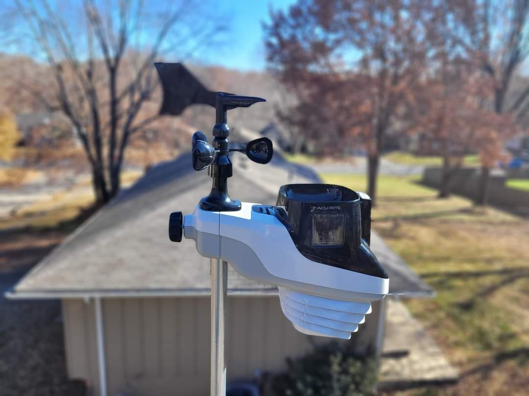
Here is Blue Springs Weather this evening. So we have been dealing with a wet day today for most of the day and into the evening. According to the Acurite Atlas, We are currently sitting at 34.7 degrees as of 7:28 pm this evening. The current pressure sits at 29.62 inches. Winds are South at 6 mph. Relative humidity at 96% and dew point at 36 degrees. According to the Accurite rain gauge, we received 0.6 inches of precipitation at this time. No lightning strikes were recorded.

Blue Springs Forecast reveals a couple of things. Snow and rain. We may be dealing with snow first thing in the morning at about 7 am, with heavy snow possible by 8 am. The WPC shows no accumulation, but it may be focused on mostly vegetation if it does accumulate. I cannot rule it completely out.

It looks like we will be dealing with some Snow starting at about 3 pm Saturday, according to the GFS. Keep in mind this weather forecast can change. According to GFS, snow amounts are sitting at about 1.7 inches. Don’t hold to that since this is the GFS and can over-emphasize things. I will have a better update

Current Weather Observations and Forecast, Severe Storms Likely

Sounding for January 2, 2023

Good morning. I hope those of you that are off in observance of the New Year is doing well. Here is the latest Blue Springs Weather to include Jackson County Weather. It is pretty foggy out. According to the HRRR, visibility will begin to open up by about 4 pm this afternoon. According to the National Weather Service in Pleasant Hill, we are under a dense fog until noon today.

...DENSE FOG ADVISORY NOW IN EFFECT UNTIL NOON CST TODAY...

* WHAT...Visibility one quarter to one half mile in dense fog.

* WHERE...Portions of east central and northeast Kansas and
  central, north central, northeast, northwest and west central
  Missouri.

* WHEN...Until noon CST today.

* IMPACTS...Hazardous driving conditions due to low visibility.

PRECAUTIONARY/PREPAREDNESS ACTIONS...

If driving, slow down, use your headlights, and leave plenty of
distance ahead of you.

Here is the latest reading from my Acurite Atlas for Blue Springs Weather. Current temperature 41.5 degrees. He have had a low of 37.9 degrees today. Barometric pressure at 29.95 inches and steady. Relative humidity at 98%. Winds are at 6 mph from the NE. Dew point at 43 degrees. Skies are cloudy. Foggy with a visual range of 0.10 miles. We had some drizzle early this morning about 5am from the fog moving into the area.

Looking at today’s forecast, we are still under a marginal chance of severe weather today according to the Storm Prediction Center. According to all the convective models. I would say that the critical time range for severe weather is between 7 pm and 2 am Wednesday morning. CAPEs seem to be just above 1000. Looking at sounding models for our area, they show the possiblity of a marginal tornado, though the Storm Prediction Center shows a very low chance of this. Tornados can happen at any time of the year and any point, it is just that they are less likly in the winter and fall time frame. Dew points will be around 60 and below during that window so there is some moisture in the air that will provide plenty of moisture for possbile severe thunderstorms.

That is about it for today. God should make it somewhat interesting this evening. I will keep an eye on things and update you with Blue Springs Weather as I see any changes. Take care everyone and be safe this evening. MP

Current Weather Conditions, Upcoming Rain, and Possible Strong Storms.

Good evening. Here is the current Blue Springs Weather. Rain is on the horizon, but here is the current weather. According to my AcuRite Atlas, The current temperature is 49 degrees. Relative humidity 76%. Dew point at 45 degrees. Barometric pressure 29.92 inches. Winds are NE at 6 mph. We had a high of 55 and a low of 32. The skies are mostly cloudy.

Monday will be a Low of 44 by 6 am and a high of 59 by 9 pm. Rain is likely to start about noon tomorrow, according to the HRRR. It will continue into the evening off and on. It looks like the heavier rain will be towards the end of the day. Rain amounts are around half an inch to three-quarters of an inch.

The SPC shows a marginal chance of severe weather and thunderstorms tomorrow. We have a 5% chance of damaging winds and large hail. Tornados are less than 2%. Looking at the convective most unstable (MU) convective available potential energy (CAPE), it does not look like the system will be too awful strong. We may hear some thunder and see some lightning, but from what I see, this system is not going to be too bad. I would not be surprised if they downgrade us.

Here is the latest on temperatures through out the week.
Tuesday Low of 47 by 9 am and high of 51 by noon.
Wednesday’s Low of 31 by 6 am, and the high of 41 by 3 pm.
Thursday Low of 26 by 6 am and a high of 37 by 3 pm.
Friday Low of 29 by 6 am and a high of 44 by 3 pm

Winter Snow Spring Temperatures

Good evening. Here I sit, checking out the weather to see when we will be out of this crazy Arctic freeze. I was encouraged to see that the last half of next week will be spring-like weather. We will talk about that here in a few moments. For now, let’s take a look at our current conditions.

Current Conditions

Tonight’s observation as of 9:27 pm shows the current temperature of 6 degrees with a pressure of 30.45 inches and steady. Likely some of you may be dealing with some pain. Winds are at 15 mph NNW and breezy. The relative humidity is 64%, with a dew point of -2 degrees. The air is very dry. In fact, the static is ridiculous in my home. The skies are clear.

[wunderground location=”Blue Springs, MO”]


We have a chance of snow on Monday at midnight. Snow amounts, according to GFS, may be up to 0.4 inches of accumulation

We will soon begin to thaw out finally. I am about tired of the snow and cold weather. We will begin to warm up on Wednesday with temps about 51 degrees. Thursday is the warmest, with the temperature in the week at 66 degrees, give or take by 3 pm. Winds should begin to die down over the next couple of hours.

That is about it for now. Take care. MP

Morning Observations / Forecast December 18 2022

Good morning. We have winter weather approaching us over the next 24 hours or so. Today’s observation as of 07:24 am shows the current temperature of 12 degrees with a pressure of 30.31 inches and steady. Winds are at zero. The relative humidity is 82%, with a dew point of 10 degrees. The air is arid. The skies are clear. I reported a trace of snow from the very light spitting of flurries yesterday with no accumulation.

Today’s Forecast is pretty uneventful. The temperature today will be a high of 37 degrees, give or take, by 3 pm. Winds will be calm today and less than ten miles per hour. Skies will clear up until about 4 pm and shift to overcast.

HRRR Temperature 3 pm.
Cloud Cover at 4 pm.

Here is an update on the winter weather approaching us this week. It looks like there may be two rounds of snow this week. The first round looks to arrive around 6 am for GFS, 7 am for RAP, and 9 am for NAM Monday, and it seems like straight snow with no transitions. Snow amounts show about a 50 percent chance of 1 inch or greater. Based on the WPC and the model’s accuracy, my determination is that it will be less than an inch unless something changes. The National Weather Service says 1 inch for the Blue Springs area. Some parts of Jackson County may see 1 inch of snow. The start time depends on which long-range model you look at. We will find a better accurate start time this evening as HRRR comes into view for tomorrow morning.

GFS 7 am Monday
RAP 8 am Monday
NAM 9 am Monday
WPC Snow Probabilities for Jackson County and Blue Springs area.

The temperature looks to reach about 38 degrees by 3 pm Monday. So there is a good chance that the snow will be mostly melted by the end of the day on Monday if it holds out. The GFS model shows a slightly lower temperature at 34 degrees. Again, we will get a better and more accurate reading this evening. Keep watching Facebook.